 |
| http://www.libs.uga.edu/darchive/hargrett/maps/1640b55.jpg |
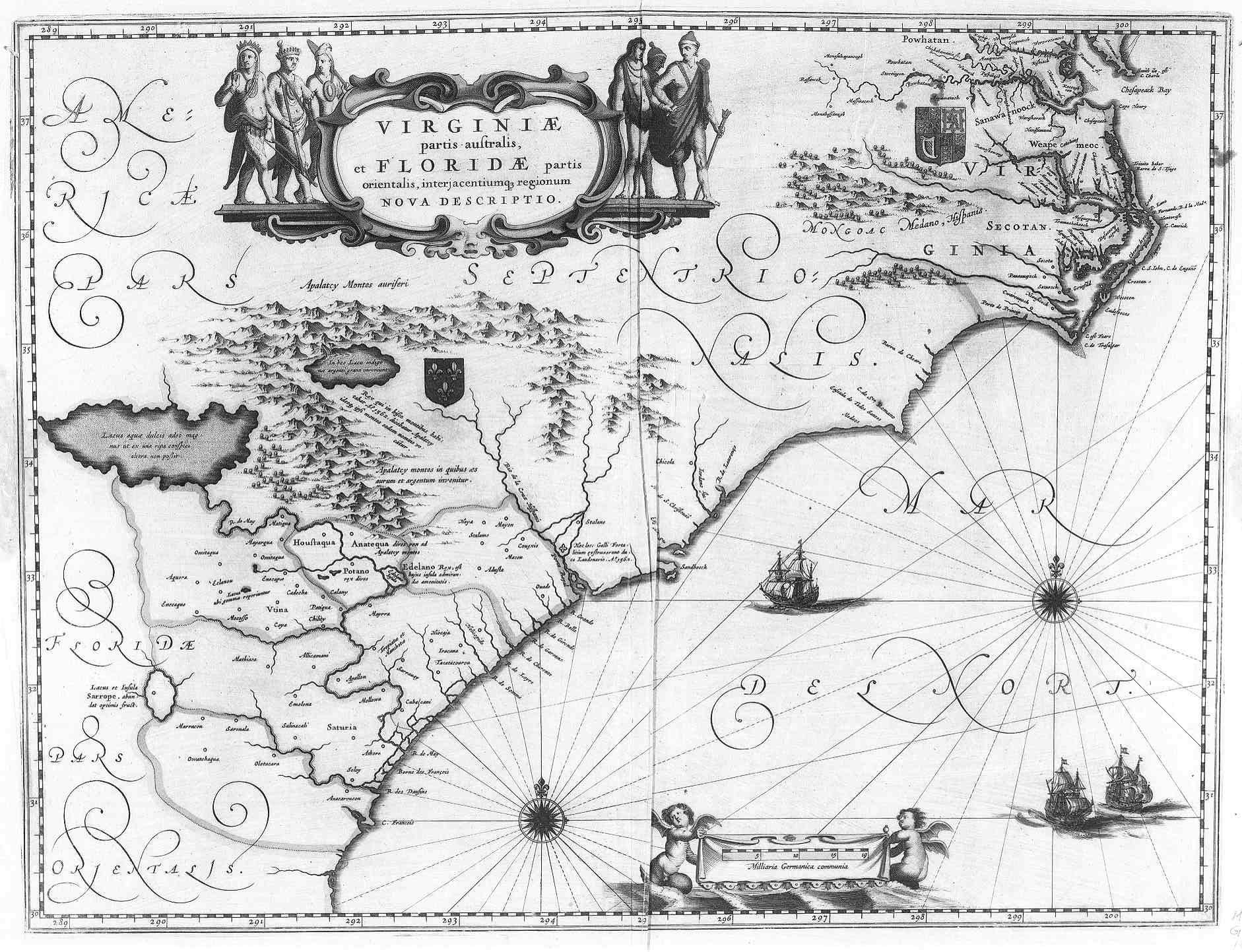
There is also evidence that this map may originate in England. The English are the first European explorers to settle Virginia, so they would naturally create detailed maps around that area. There are also English Royalty symbols (such as the three spade-shaped spear heads) found within the two banners located on the land regions.
Another significant detail is the drawing of the natives surrounding the map's title. They appear more primitive with being scantly clothed, displaying their "savage" and "primitive" features. This only reinforces the stereotype of that time period: that the Natives are inferior to the white Europeans. This is also displayed in how the map labels the European settlements and Native American tribal regions. The European towns are written orderly and uniformity with each settlement's name running parallel. On the other hand, the Native American regions are written like geographical features. The names of tribes are stretched or twisted to fit the general land with which they occupy. This contributes to the sense of inferiority while giving the vibe that their land is there to be conquered like any other land. As Valerie Babb writes, "...a growing sense of European entitlement to the Americas is evident..." (page 50).
